Subsidence risk by UK town, city and council
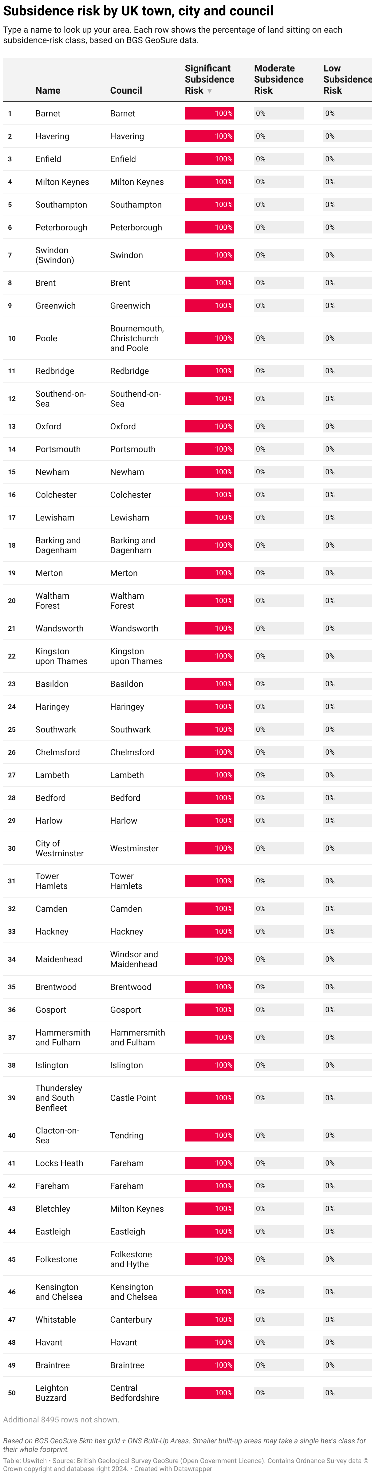
Type a name to look up your area. Each row shows the percentage of land sitting on each subsidence-risk class, based on BGS GeoSure data.
Type a name to look up your area. Each row shows the percentage of land sitting on each subsidence-risk class, based on BGS GeoSure data.
