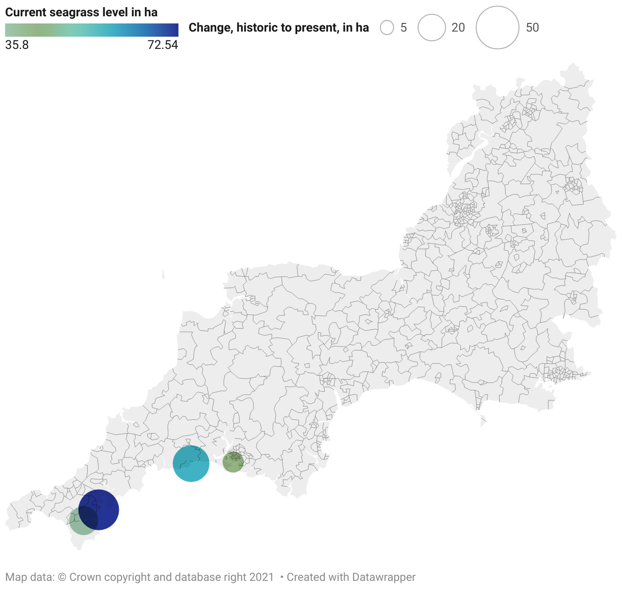
A map of the South West showing round symbols that represent the level of seagrass present in different locations in Cornwall and Plymouth Sound, Devon (shown by the colour) and the estimated level of loss since 1936 (shown by symbol size).
Cornwall to Plymouth Sound: estimates of seagrass loss
Illustrative data showing estimated loss – in hectares (ha) – of seagrass in different locations in the south west.