The climate housing bubble
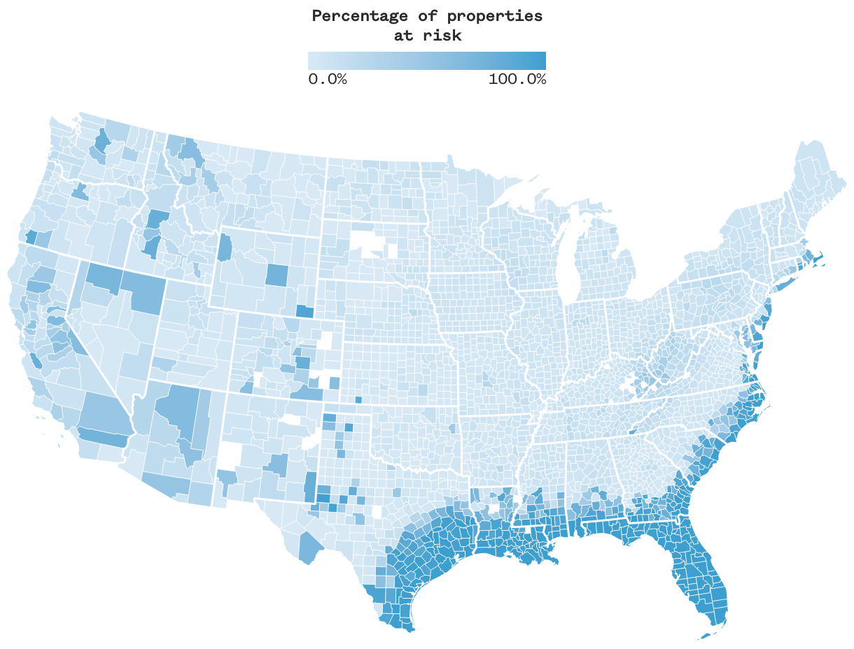
Sixty-six million Americans live in a county where at least half the properties in it are vulnerable to dramatic changes in insurance coverage.
A color-coded county map of the contiguous United States, with colors showing the share of properties in a particular county that are vulnerable to insurance correction due to flooding, wildfires or hurricanes. All of Florida is highly vulnerable, with swaths of vulnerability stretching from there out across the Gulf Coast shore through Alabama, Mississippi, Louisiana and Texas. Vulnerability stretches north across the East Coast shore up through Massachusetts. There are light pockets of vulnerability in West Virginia and Kentucky, and spotted vulnerabilities across the Western U.S.