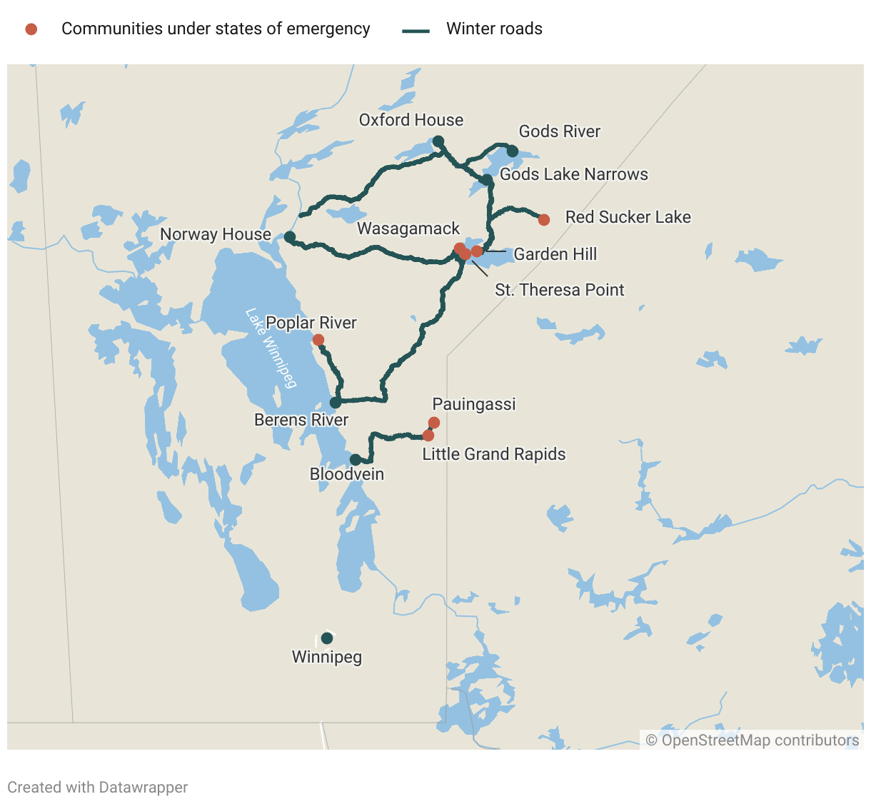
Seven Manitoba First Nations declared states of emergency after delayed start to 2024 winter-road season
With climate change bringing increasingly unpredictable weather, remote Manitoba First Nations are struggling to build and maintain the 2,200 kilometres of winter roads long enough to import an annual supply of basic infrastructure needs. At the southernmost extent of the winter-road network, this year's unseasonable conditions have left several communities in crisis.
A map of the eastern side of Manitoba depicting 13 First Nations communities (Bloodvein, Little Grand Rapids Pauingassi, Berens River, Poplar River, Norway House, Oxford House, Gods River, Gods Lake, St. Theresa Point, Garden Hill, Wasagamack and Red Sucker Lake) linked by a network of winter roads (shown in blue). The seven First Nations with states of emergency in effect (Little Grand Rapids, Pauingassi, Poplar River, St. Theresa Point, Garden Hill, Wasagamack and Red Sucker Lake) are depicted with orange dots. Winnipeg is shown at the bottom of the map with a blue dot.